Chris Craft Commander Yacht
Monday, May 14, 2012
Miami Captain Joe - Miami Beach, Florida - Chris Craft Commander Yacht
We were out with some friends
the other night, had a fantastic time, many thanks to Captain Joe and Paulina ! Joe is a
Captain and runs a boat rental operation directly across the street from the Eden Roc Hotel
in Miami Beach, If anyone is looking for a nice excursion during the
day or night with their sweetheart or with just a group of friends
visit Joe and Paulina, your experience on the Chris Craft Commander Yacht will be
unforgettable. They also rent smaller crafts for exploring the
surrounding Miami Beach area. They can even provide you with a
captain if you're not familiar with the Intercoastal area. Give them a visit and tell them you read about them here on the "South Florida Marine Directory" ..... www.miamicaptainjoe.com
Friday, April 27, 2012
Islamorada Fishing Charters
A charter fishing trip in the Florida keys to
Islamorada can be the vacation of a lifetime. Many anglers rate the deep
sea fishing in Islamorada as some of the best in the world. The rich
waters of the Gulfstream current and the bait schools of the Florida
Keys National Marine Sanctuary produce an incredible year round fishery.
It is time you came to see for yourself what is waiting for you in
Islamorada, the Sport Fishing Capital of the World and Florida Keys
Charter Fishing gem.
Capt. Greg Eklund has been guiding Sportsman on Florida keys fishing charters to their dreams for most of his life. Through out his career he has developed many techniques that he and his anglers have used to catch more fish. He has also won more than 15 Blue Marlin, Sailfish and Dolphin tournaments in the Florida Keys and Carribean in the past 10 years. Most recently, a first place win in the 2011 Central Abaco leg of the Bahamas Billfish Championship and third place in the 2011 Islamorada Junior Sailfish Tournament. As a professional charter captain and accomplished angler he shares his experience with anglers of all levels. Capt. Eklund says “Islamorada offers my anglers an amazing opportunity to catch more than 50 species of game fish. In fact it is common for our guests to catch a variety of species every day.”
Capt. Greg Eklund has been guiding Sportsman on Florida keys fishing charters to their dreams for most of his life. Through out his career he has developed many techniques that he and his anglers have used to catch more fish. He has also won more than 15 Blue Marlin, Sailfish and Dolphin tournaments in the Florida Keys and Carribean in the past 10 years. Most recently, a first place win in the 2011 Central Abaco leg of the Bahamas Billfish Championship and third place in the 2011 Islamorada Junior Sailfish Tournament. As a professional charter captain and accomplished angler he shares his experience with anglers of all levels. Capt. Eklund says “Islamorada offers my anglers an amazing opportunity to catch more than 50 species of game fish. In fact it is common for our guests to catch a variety of species every day.”
To read more about our Islamorada Fishing Charters Click Here.
Current Events
It is January 2012 and the SAILFISH are Biting off the key of Islamorada. Call Now to book your day before they fill up. Fishing in the Keys doesn't get any better!!!
Plan your next deep sea fishing trip to Islamorada with expert help from Capt Greg Eklund !
The 2011-2012 winter fishing season is here. Call Capt. Greg to discuss putting your fishing trip of a lifetime together.
You Can Make your reservation HERE or check the fishing report for current updates.
Shipwreck Trail
Visitors are encouraged to explore the sites along the trail. An underwater guide is available for each site on the Shipwreck Trail, providing the shipwreck and mooring buoy positions, history, a site map, and information about marine life divers might encounter. Conditions on the Shipwreck Trail sites vary from easy dives in shallow water to deeper dives of l00 feet or more where swift currents may be encountered. Some of the deeper sites require mooring to submerged buoys.
Please help protect the sites on the Shipwreck Trail, and all the sanctuary’s maritime heritage resources, so that they may be enjoyed by future generations. When diving, remember to control your buoyancy, since shipwreck structures can be as fragile as the marine life they support. Disturbance and removal of artifacts is prohibited. It’s best to leave these pieces of history where they are, for other divers to enjoy and for historians to document.
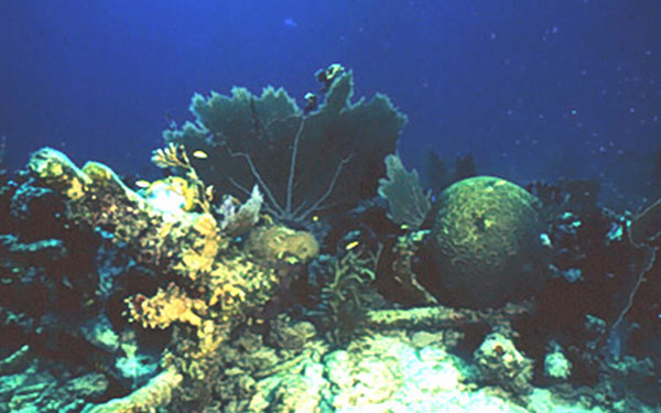 The Adelaide Baker
 In 20 feet of water, four miles south-southeast of Duck Key, lie the remains of a three-masted iron-rigged and reinforced wooden-hull bark. The major features of this ship, locally known as the Conrad and believed to be the Adelaide Baker, are scattered over a square quarter-mile area. More…
 The Amesbury
The Amesbury, locally known as Alexander’s Wreck, was built as a U.S. Naval destroyer escort in 1943 and was later converted to a high-speed transport vessel. While the vessel was being towed to deep water to be sunk as an artificial reef, it grounded and broke up in a storm before it could be refloated. More…
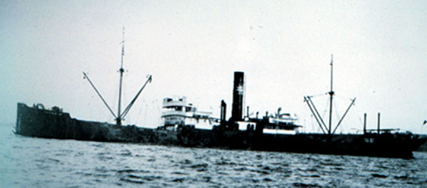 The Benwood
The Benwood was built in England in 1910 and sunk in 1942 when it collided with another ship. She lies between French Reef and Dixie Shoals on the bottom of a low profile reef and sand, in depths ranging from 25 to 45 feet. More…
 The City of Washington
In 25 feet of water east of Key Largo, the remains of the City of Washington lie on Elbow Reef. On July 10, 1917, while being towed by a tug, the City of Washington ran aground and was a total loss within minutes. More…
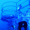 The Duane
The U.S. Coast Guard cutter Duane lies upright on a sandy bottom in 120 feet of water one mile south of Molasses Reef off Key Largo. After being decommissioned on August 1, 1985, as the oldest active U.S. military vessel, the Duane was donated to the Keys Association of Dive Operators for use as an artificial reef. More…
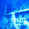 The Eagle
The Eagle lies on her starboard side in 110 feet of water three miles northeast of Alligator Reef Light. On the night of December 19, 1985, while waiting to be sunk as an artificial reef next to the Alexander Barge, the Eagle broke from her moorings. More…
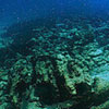 The North America
 Although not confirmed, this shipwreck may be the North America, built in Bath, Maine, in 1833 and lost November 25, 1842, while carrying dry goods and furniture. She lies in 14 feet of water in the sand and grass flats north of Delta Shoals, just east of Sombrero Key Light. More…
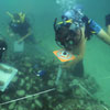 The San Pedro
 The San Pedro, a member of the 1733 Spanish treasure fleet caught by a hurricane in the Straits of Florida, sank in 18 feet of water one mile south of Indian Key. She is the oldest shipwreck on the Shipwreck Trail, with the mystique of a Spanish treasure shipwreck to draw divers and snorkelers alike. More…
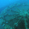 The Thunderbolt
The Thunderbolt was intentionally sunk on March 6, 1986, as part of the Florida Keys Artificial Reef Association project. She now lies intact and upright on a sand bottom in 120 feet of water four miles south of Marathon and Key Colony Beach. More…
How to Use a Mooring Buoy
How to Use a Mooring Buoy
Download (19 MB, QuickTime)
It’s important to use a mooring buoy correctly to prevent
unnecessary wear and tear on the mooring system, as well as protect
your vessel and the vessels of others. There is no fee to use the reef
mooring buoys maintained by the sanctuary, but there are mooring buoys
in anchorages throughout the Keys that do charge a fee. - Buoys are available on a first come, first served basis.
- Steer the boat from a helm station that enables you to see the buoy during the entire hook up.
- Approach slowly from down wind or down current, so that the
floating yellow pick-up line is closest to you. Keep the buoy on
the same side as the helm station so you can see it as you
approach.
- Safely retrieve the yellow pick-up line with a boat hook. Put your vessel in neutral to avoid entanglement.
- Run your boat’s bow line through the loop of the yellow
pick-up line. Cleat both ends of your bow line to the bow of your
boat. Never tie the yellow pick-up line directly to your boat as it puts
undue stress on the mooring anchor.
- Let out enough line so that the buoy is not pulled
underwater and the line is horizontal. Rougher days may require even
more line. Adding extra line will produce a more comfortable
experience for your vessel while moored and reduce wear on the
buoy system.
- Inspect the buoy your boat is tied to; you are responsible for your vessel. Check that it is holding as intended and report problems to any of the sanctuary offices.
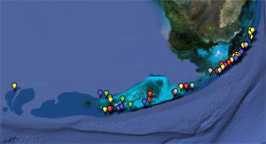 Click on the map to see the locations of buoys within Florida Keys National Marine Sanctuary, or view a complete list of all sites with buoys in the sanctuary.
 When using mooring buoys, here are a few additional things to consider:
- At many reefs, mooring buoys encircle the shallowest reef
areas or are located on the ocean side of the reef. Approach
mooring buoys from around either side of these shallow areas,
always steering to the outside of a ring of buoys. Never motor
directly across a shallow reef to get to a buoy.
- You should maintain idle speed/no wake in the vicinity of
the mooring buoys. Do not meander among the buoys and watch for
swimmers, snorkelers, and diver bubbles.
- If there are no buoys available, anchor only in sand, never
in coral. Always check to be sure that your anchor is not dragging
and your anchor chain is not contacting coral.
- Smaller boats are encouraged to tie off to one another, thereby allowing larger vessels access to buoys.
- Sailboats should not leave up large sails as steadying sails
when on a buoy; this puts too much strain on the mooring’s
eyebolt.
- Buoy locations have been spaced to provide clearance for
most boats when tied up during normal conditions. To avoid
grounding, use caution when approaching and while tied to a buoy.
Larger-than-average vessels must check depths so that contact with
the bottom is avoided.
- Florida Keys National Marine Sanctuary assumes no liability for use of the buoys.
Blue Star Program
Why should you book with a Blue Star operator? These operators have made a commitment to educate you on how to be better environmental stewards and to interact responsibly with coral reefs in the Keys. This is important because the coral reefs of the Florida Keys are stressed by a range of somewhat daunting factors, including overuse by uninformed or irresponsible visitors. Luckily, unlike some of the major causes of reef decline such as climate change, damage to reefs from diving and snorkeling can be immediately prevented.
Visit the Blue Star website to learn more about the program and to find a list of currently recognized Blue Star operators.
Sanctuary Marine Zones
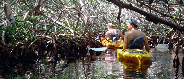
Just as areas of land may be set aside for specific uses, so too can parts of the ocean. Marine zones can help protect sensitive natural resources from overuse, separate conflicting uses, and preserve the diversity of marine life in an area. Zones are an important tool for managing marine resources and have been used around the world.
Florida Keys National Marine Sanctuary established the nation’s first comprehensive network of marine zones in 1997 after years of planning, design, and public input. The sanctuary’s zones are designed to protect and preserve sensitive parts of the ecosystem while allowing activities that are compatible with resource protection.
To learn more about the background of Florida Keys National Marine Sanctuary, visit the links below.
Types of Marine Zones
The sanctuary created five different types of zones with varying levels of protection. Each type of zone has a slightly different purpose, and with it a different set of rules. More…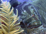
Marine Zone Monitoring Program
Researchers have been studying the coral reefs, other habitats, and marine life inside highly protected marine zones and comparing them to reference sites outside the zones. More…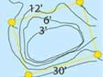
Marine Zoning and Regulatory Review
The sanctuary and its advisory council are conducting a review of sanctuary and wildlife refuge boundaries, marine zones, and regualtions. More…Ocean acidification monitoring buoy installed at Cheeca Rocks
Visitors to Florida Keys National Marine Sanctuary may notice a recent addition to the reef near Cheeca Rocks: a sophisticated new monitoring buoy. NOAA scientists from the Atlantic Oceanographic and Meteorological Laboratory and partners from the University of Miami’s Cooperative Institute for Marine and Atmospheric Studies deployed the buoy in December 2011 under permit from the sanctuary. The large yellow ‘MApCO2’ buoy sits roughly three feet above the waterline and along with subsurface instruments, simultaneously measures the concentrations of carbon dioxide in the atmosphere and ocean. Divers and boaters are asked to keep clear of the buoy.
Ocean researchers are studying ocean acidification — changes in ocean chemistry resulting from rising levels of carbon dioxide in the atmosphere then absorbed by the ocean. The Cheeca Rocks buoy is part of the Atlantic Ocean Acidification Test Bed,funded by NOAA’s Coral Reef Conservation Program.
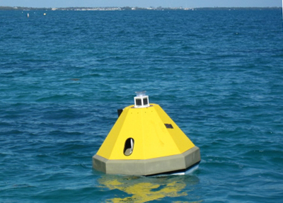 MApCO2 buoy at Cheeca Rocks
Special-use Areas
The sanctuary’s four Special-Use Research Only Areas are located at Conch Reef, Tennessee Reef, Looe Key (patch reef), and Eastern Sambo.
The following activities are prohibited in Special-use Research Only Areas:
- No entry or activities without a Florida Keys National Marine Sanctuary permit.
- Discharging any matter except cooling water or engine exhaust.
- Fishing by any means; removing, harvesting, or possessing any marine life.
- Touching or standing on living or dead coral.
- Anchoring on living or dead coral, or any attached organism.
While there are currently no other types of Special-use Areas within the sanctuary, there are three other types of Special-use Areas possible in the zoning scheme. “Restoration” or “recovery areas” may be implemented for the recovery or restoration of injured or degraded resources; while “facilitated-use areas” can be created to prevent user conflicts and to enhance access or use of sanctuary resources. Regulations may confine or restrict activities such as personal watercraft operation and live-aboard mooring.
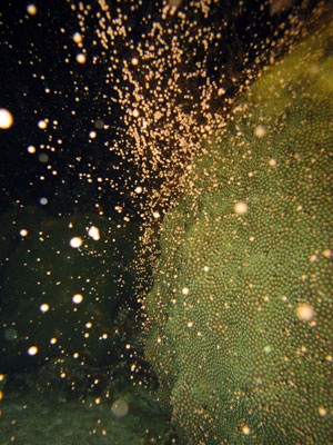
Spawning in Boulder star coral
Corals reproduce asexually by budding
or fragmentation. Through budding, new polyps “bud” off from parent
polyps to form new colonies. In fragmentation, an entire colony (rather
than just a polyp) branches off to form a new colony. This may happen,
for example, if a larger colony is broken off from the main colony
during a storm or boat grounding.In terms of sexual reproduction, some coral species, such as Brain and Star coral, produce both sperm and eggs at the same time. For other corals, such as Elkhorn and Boulder corals, all of the polyps in a single colony produce only sperm and all of the polyps in another colony produce only eggs.
Coral larvae are either fertilized within the body of a polyp or in the water, through a process called spawning. In some areas, mass coral spawning events occur one specific night per year and scientists can predict when this will happen.
Once in the water, larvae ‘swim’ to the ocean surface. If they are not eaten, they eventually settle to the ocean floor and attach to a hard surface. Once attached, they metamorphose into a coral polyp and begin to grow, dividing in half. As more and more polyps are added, a coral colony develops and eventually begins to reproduce.
More than 1,500 Rescued Corals Given Second Life
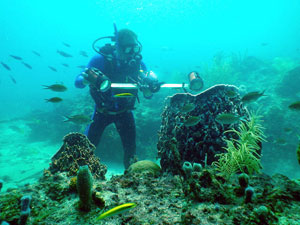
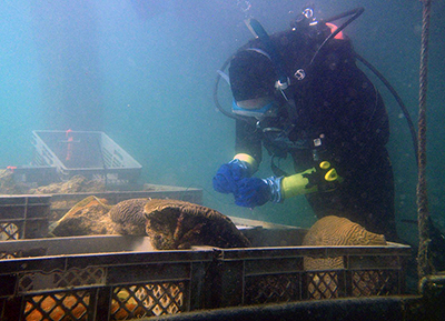
Navy staff and contractors, trained by the sanctuary in coral removal and handling, cleared a 425-foot long stretch of seawall of the largest corals, some of which spanned over two-feet wide. The corals, representing 19 different species, have been placed in the sanctuary’s nearby coral nursery and partner nurseries where they will be cared for until they can be placed into beneficial use projects, including the restoration of vessel grounding sites in the Keys and research projects.
“It’s critical that the Navy repair this seawall as it is an integral part of the Navy’s Key West fleet support facilities,” said Edward Barham, NAS Key West’s environmental director. “It’s a win/win/win situation, the Navy repairs its pier, the sanctuary protects natural resources, and the rescued corals will be used for research, education and reef restoration.”
Before nearshore construction occurs in the Florida Keys, the sanctuary reviews the proposed project and determines if any sanctuary resources, such as coral, will be harmed through construction. The sanctuary and works closely with local, state, and federal agencies to ensure that required permits are issued for projects while resources are protected.
“We applaud the efforts of the Navy to limit impacts to the healthy corals which thrived on its seawall,” said Lauri MacLaughlin, sanctuary resource manager. “Through our permitting process we were able to ensure that construction could continue, and that these valuable resources could be given a second life in research, restoration and education projects in the Keys, and across the country.”
In the next phase of coral rescue, permitted partners from accredited zoos, aquariums, and conservation organizations removed from the seawall corals less than six inches in diameter, allowing the smallest of the corals to be showcased in educational facilities and used in research projects. Partners include: Florida International University, Georgia Aquarium, Mote Marine Laboratory, Shedd Aquarium, The Florida Aquarium, The Pittsburgh Zoo & PPG Aquarium, University of Miami RSMAS and others.
SPCMSC Scientist Releases Report on Hurricane-Induced Coastal Erosion Hazards
SPCMSC Scientist Releases Report on Hurricane-Induced Coastal Erosion Hazards at Science Policy Conference
The USGS Coastal Change Hazards group in St. Petersburg, Florida will release a report in early May that quantifies hurricane-induced coastal erosion hazards for sandy coastlines in the Gulf of Mexico. Modeled storm conditions and measured beach elevations were used to calculate the likelihoods of dune erosion, overwash, and beach inundation during landfall of category 1-5 hurricanes. Results indicate that approximately 70% of the beaches on the US Gulf of Mexico shoreline are vulnerable to extreme erosion associated with overwash during a category-1 hurricane landfall. USGS Oceanographer Hilary Stockdon will present the results of the study, “'National Assessment of Hurricane-induced Coastal Erosion Hazards: Gulf of Mexico,” at the American Geophysical Union (AGU) Science Policy Conference in Washington, DC, May 1-2, 2012.A Tool to Minimize Risk for Marinas and Yacht Clubs
ACE USA Marine Facilities Group Provides Stray Electric Current Safety Checklist for Marinas and Yacht Clubs
A Tool to Minimize Risk for Marinas and Yacht Clubs
Marinas and yacht clubs routinely allow boats of all sizes and conditions to plug into their shore power systems. Every time they do, owners and operators of marine facilities face the possibility that stray electric current may escape into the water. At risk are vessel damage and sinkings, as well as the more serious potential for lethal injury to swimmers and inspectors. A well thought out dock electrical safety management plan may significantly reduce the number and severity of stray current incidents.Prepared by ACE Marine Facilities loss control specialists, the checklist includes tips for addressing stray electric current risks, including:
- Swimming
- Diving operations
- Electrical equipment installation
- Electrical wiring inspection
- Berthed vessel condition and valuation survey
- Slip rental agreement pointers
- Fast, flexible underwriting response
- Solutions and policy terms tailored for the size and complexity of exposure
- Access to Marine Advisory Services specialists
Thursday, April 26, 2012
A Tribute to the Life of Legendary Angler Jose Wejebe 1958 - 2012
Jose Wejebe, host of the immensely popular saltwater fishing and fly fishing television show Spanish Fly on the Outdoor Channel.
Subscribe to:
Posts (Atom)


